Wednesday 23 September 2009

London Countryway 8: Great Missenden - Berkhamsted

chartridge

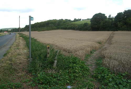
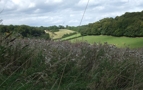
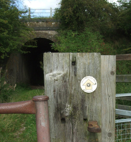
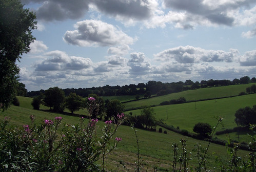
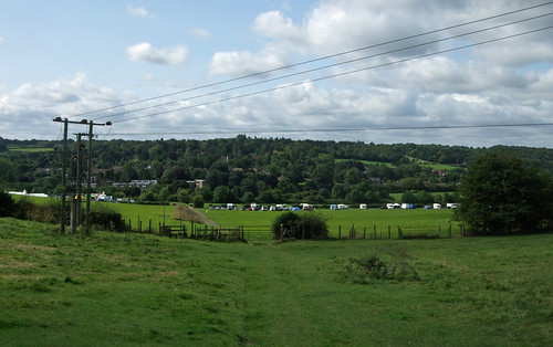
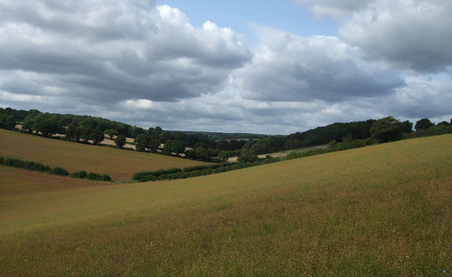
The London Countryway leaves the A413 and the South Buckinghamshire Way on the edge of Great Missenden to climb the east side of the uppermost reach of the Misbourne valley, tracing the edges of arable fields to continue its relatively uneventful journey across the rolling chalk ridges of the Chilterns Area of Outstanding Natural Beauty (AONB). Some sort of outdoor event is taking place in the fields just off the main road as I pass, with an assemblage of inflatable recreation facilities. So today's walk starts with a bouncy castle, and ends at Berkhamsted with a real ruined one.

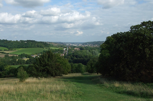
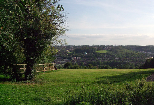
The path runs uphill relatively gently, with views behind to the Misbourne valley, to cross the first of a series of lanes running along the flat ridgetops.

misbournevalley

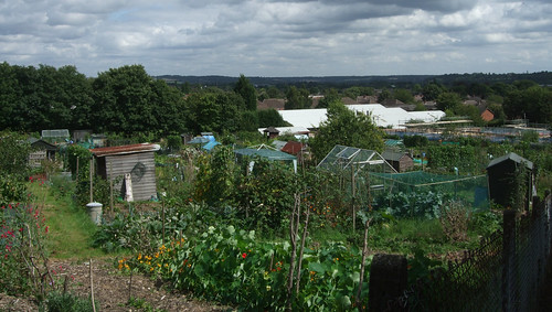
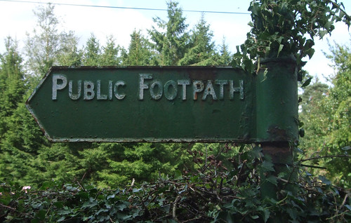
It emerges at a little collection of houses and farms at Potter Row, where by allotments there's an old style metal footpath sign pointing back the way we came.

potterrowfingerpost

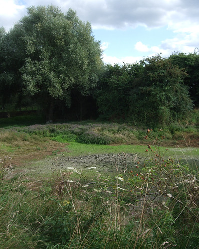
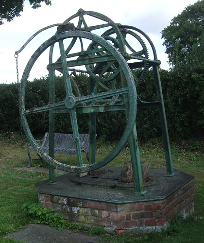
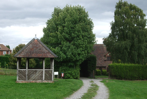
Just where the next section of path strikes out across the fields is a small grassy square with a bench and a well head topped by some old mechanical lifting gear, looking serious enough to belong in a mine or quarry. Wells were a serious business up on these ridges: the porous chalk makes ground water scarce and the water table low, necessitating deep digging to reach it.

potterrowwell

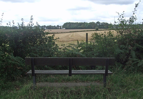
The next path cuts diagonally across more fields on clear paths, emerging onto a bridleway at Field Edge Grange where a bench tempts you to linger and enjoy the spot. then wiggles around a pretty farm and cottages at Field End Grange. The bench commemorates Emily Morris (1891-1976) and her three children, all now dead, of the Lee, the settlement just a little over to the left.

ballingerbottombench

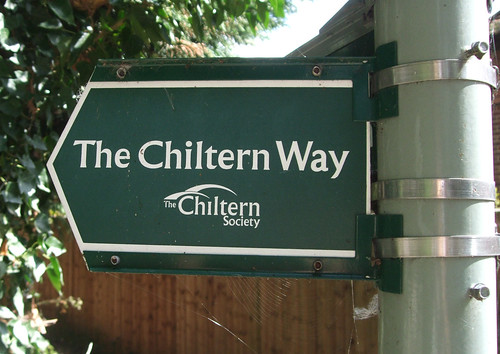
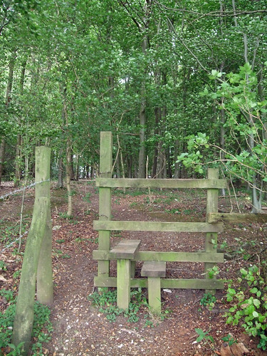
Beyond this the route descends slightly towards a strip of woodland which is presumably all that remains of Lee Common. Here the Countryway picks up a path that tracks the wooded strip, joining not only another section of the meandering Chiltern Heritage Trail but one of Buckinghamshire County Council's network of walking routes, the Chiltern Link. This short 13km trail was created to plug a strategic gap between the Chess Valley Way at Chesham and the Ridgeway at Wendover, and is based on an ancient trade route that used to link the two. In fact you can pick out a whole skein of almost parallel northwest - southeast roads and paths: the ridges and the routes fan out northwest from Chesham towards the main Chiltern dip.

Unlike many other European countries, no central organisation has yet emerged in the UK to oversee the development of a long distance walking network, but if ever anyone did set about sorting out the current sprawl, and conceived, for example, a long north-south route between Scotland and the south coast via London, their gaze might well fall on this little stretch of path through a pleasant but modest ancient Buckinghamshire woodland. Northwestwards, the Chiltern Link connects not only with the Ridgeway but the Aylesbury Ring, a circular route through the countryside around that town. A little way along that route, past Great Kimble, there's a junction with the North Buckinghamshire Way towards Milton Keynes. As mentioned in the previous section, the North Bucks Way is the first link in a longer chain of routes, the Midshires Way, connecting to the Pennine Way and the Pennine Bridleway National Trails that take ambitious walkers a long way north to the Scottish border. There are various options of shorter trails to close missing links in the Scottish Borders and Southern Uplands but you could reach Edinburgh, or Glasgow which has a continuous link to Inverness via the West Highland and Great Glen Ways.

Southeast the Countryway provides a link to the Hertfordshire Way; in turn this links to the Watling Chase Trail, the London Loop and the Dollis Valley Greenway, with the potential of a link through Hampstead Heath, along the Belsize Walk and through Regents Park to central London, a trajectory I'll eventually explore in more detail in this blog.

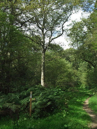
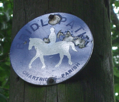
The Chiltern Link reaches a lane at Ballinger Bottom, a cluster of pretty cottages in a well-wooded dip, and from here there are several parallel routes tracking the edge of a ridge. The Countryway chooses a pleasant bridleway that hugs the northern edge of another strip of rich beech woods, with fields sloping steeply up to the left, leaving the Link past a tree house, though take care as the junction is narrowly angled and the fingerpost points between the two options. After a more open section the bridleway zigzags around the edges of blocks of woodland adjoining at right angles -- the paths here are very well kept and well signed, with the local parish council of Chartridge using their own bridleway signing.

chartridgebridlepath

After a short sharp climb the route joins a fine track between old hedges, hugging a contour with open views of fields, almost as though you're flying across the ridges. Reaching Chartridge I pass a cricket ground with a match in progress, and note with some surprise that this is the first example of such a stereotypically rural English scene that I've encountered on the whole walk, and so late in the season. Here once again the route dallies with the Chiltern Heritage Trail.

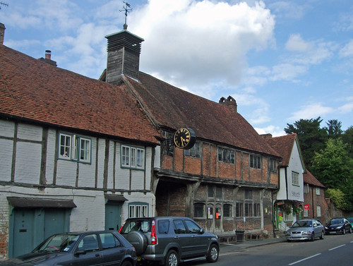
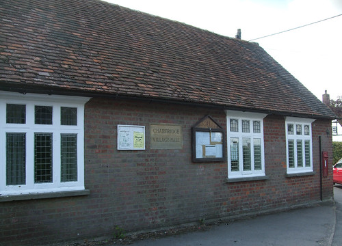
Chartridge -- "Caerda's Ridge" from an Anglo-Saxon personal name -- is a linear ridgetop village on what became the metalled road from Chesham to Wendover (these days it's faster by car to head for Great Missenden and take the A413). On the corner where we join the village street is Chartridge Village Hall and Reading Room, converted from an old blacksmith's shop in 1919 by Caroline Franklin, wealthy founder of the local Women's Institute.

chartridgevillagehall

Wheeler and her husband lived at Chartridge Lodge a little further towards Wendover, which they expanded and converted from a modest farm into a luxury home. It's now a posh residential conference centre and the base of a company that owns a whole network of such venues.

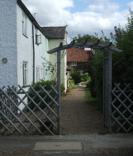
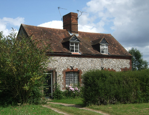
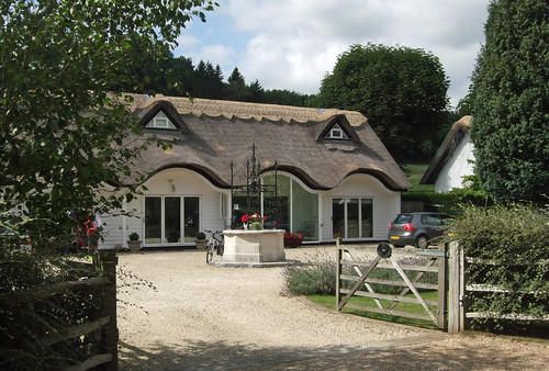
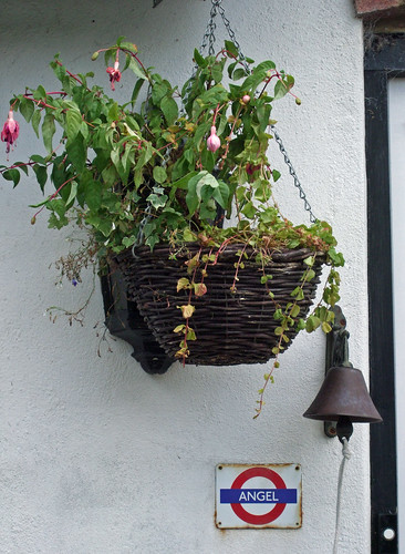
The path from Chartridge leaves by Chartridge Mission Church, a simple, small and neat chapel originally built for the Baptist congregation in 1844. I've noticed a number of these little chapels along the way and wonder if historically nonconformism had a particular appeal in the Chilterns. The path passes some pretty white cottages, one of which, in an unexpected echo of inner London, appears to have borrowed an Underground station sign from the Angel Islington, on display below a hanging basket. Angel is also on the route of the Jubilee Greenway. I'm becoming aware that the architectural character is changing, with flints giving way to stone and whitewash.

angel

Then it's down and up again, with fine views behind, to the next ridgetop hamlet, Asheridge, little more than a row of houses along a lane.

chartridge-asheridge

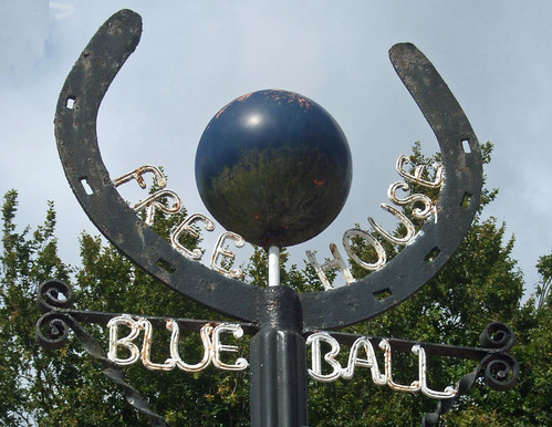
Here, turn left for a few paces rather than right to find a decent small pub, the Blue Ball, with an unusual sign: rather than the traditonal painted board, there's a three dimensional blue ball surrounded by a horseshoe at the top of a post. Patches of corrosion on the ball look strikingly like the continents of a fictitious planet, set against azure oceans.

blueballsign

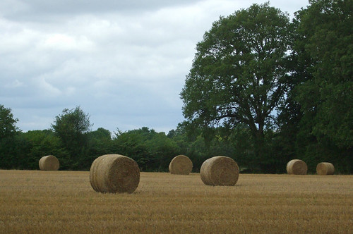
From Widmore Farm, Asheridge, a concrete track passes a curious black wooden building on stilts and runs through fields where, here at the end of summer, rolled bales of hay form random patterns.

rolledbales

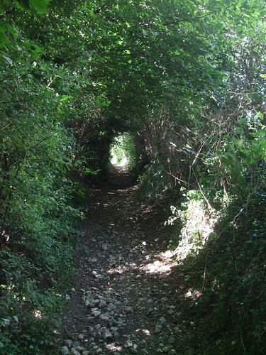
Then once more down and up, through a small wood, Widmore Wood, and up the next valley edge. Keith Chesterton, devisor and original describer of the Countryway, compares these waves of dry valleys to the Welsh Borders and you can see what he means, yet you could walk briskly to the tube station at Chesham from here in less than an hour. I wonder if the prevalence of chapels subconsciously reinforced the comparison.

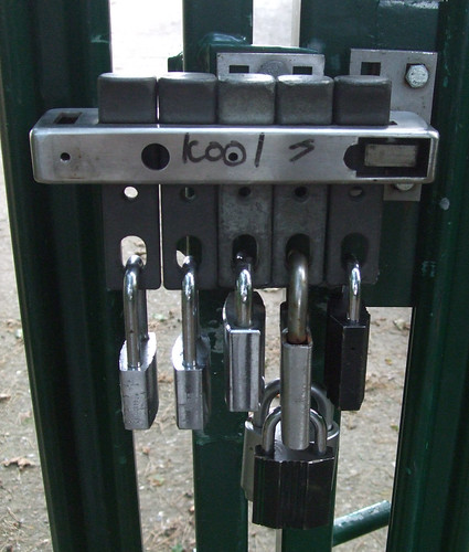
On the next ridge is the more sprawling linear hamlet of Bellingdon, with another chapel. Here the route wiggles to pick up an old byway towards Ramscoat Wood. There is no right of way on the desire line straight down the ridge, but, writing in 1981, Chesterton tips his readers that local people simply go straight ahead down the edge of the wood anyway. In the intervening years someone has decided to put a stop to this, installing a sturdy fence, restoring the hedgerow and putting up "No public right of way" signs. I fail to understand this mindset -- I can't see any good land management reasons why the public shouldn't walk down the edges of these particular arable fields as it does along so many others that have an official right of way. Landowners may be concerned about the legal principle of presumed dedication, where if people use a path for 20 years without any evidence of a landowner trying to prevent them, it's presumed the landowner intended to dedicate the path as a right of way. But there are ways round this by opening up a path permissively with notices denying there's any intention to dedicate.

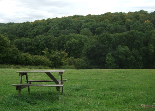
I duly walk around three sides of a square, cutting through the centre of the wood on the byway and then tracking back along the other side of it, briefly entangling with the Chiltern Heritage Trail again, before resuming my course uphill. Just below the summit, a more public-spirited person has placed a picnic bench in a well-chosen spot.

bellingdonbench

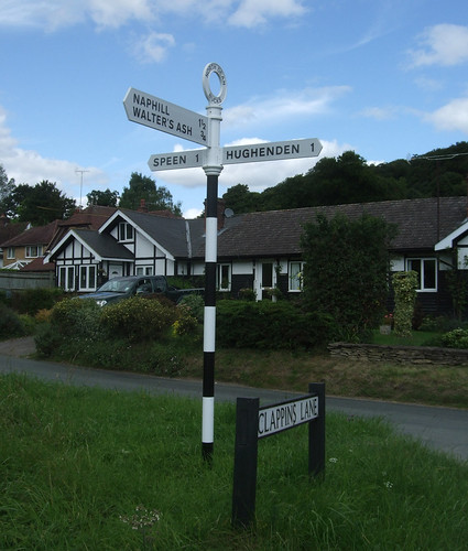
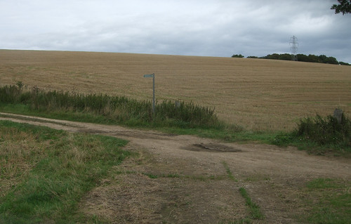
This is Hawridge, but there's no village astride it at this point, just a broad field bisected by a ridgetop path. Crossing this I descend to Nut Hazel Cross, no more than a farm on a junction of minor roads, but enough to qualify for its own named traditional fingerpost. The junction sits on a parish boundary and may have had a special significance in "beating the bounds" ceremonies.

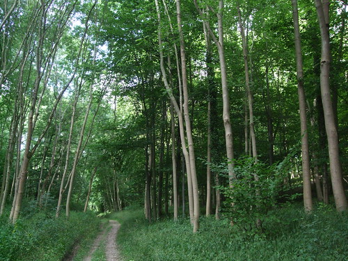
The thin band of woods at the top of the next rise is managed under the Chiltern Woodlands project, started as the Small Woodlands Project by the Chiltern Society in 1989 and now an independent charity that conserves local woodlands, supporting land managers to implement sustainable forestry and public enjoyment.

nuthazelcrosswoods

On the other side you're out into the fields of Woodlands Farm, where you can't fail to notice the sturdy branded waymarker posts signing not only rights of way but a network of permissive paths, yet this is private commercial farmland, not part of a public or charity estate. Since 1999 the farm has been part of the landholdings of Copas Farms, based in Cookham, which we passed a few sections ago, and the company has a policy of welcoming public access, including providing open spaces and conservation areas and organising led farm walks, "in an effort to encourage people to understand farming, the countryside and wildlife." This progressive attitude is perhaps informed by the importance of the Pick Your Own market to Copas' business -- they are clearly used to welcoming the public to their land. But even so their attitude is praiseworthy and all too rare, such a contrast to the shortcut-blockers a little way behind us.

woodlandsfarm-tree

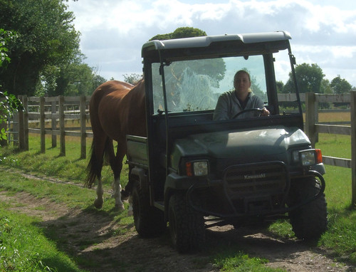
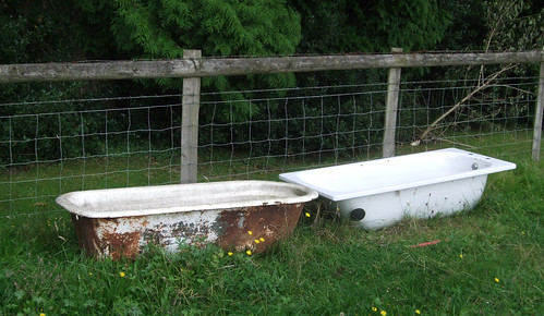
On the other side of Copas' fields I pick up a path which first runs alongside small paddocks, passing the second tree house I've spotted today, and then diagonally through them, via a series of well-maintained gates, passing two baths recycled as cattle troughs that present an incongruous site.

ashleygreen-baths

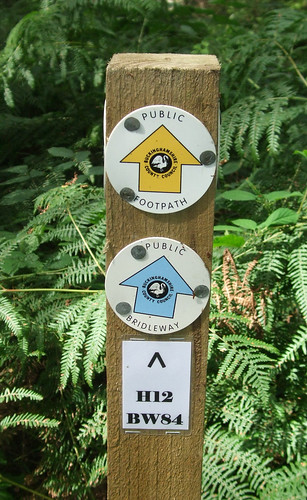
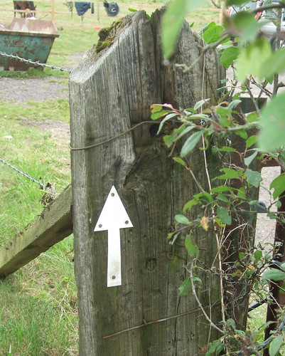
The local Parish Paths Partnership, a scheme where local people and the parish council can obtain small amounts of funding from the county or unitary council to improve their footpath network, has been active here. And here and elsewhere you'll also spot the Chiltern Society's white arrow waymarks, adopted before the now-standard yellow, blue, red and plum right of way arrows were introduced nationally.

chilternarrow

The path emerges on Hog Lane on the outskirts of the village of Ashley Green, and yet again the Heritage Trail signs are on display. Ashley Green is a classically quaint village centred on a thin triangular green. Its position on the road between Chesham and Berkhamsted, only a short drive from the tube station at the former, makes it attractive to better off commuters. The flint and Bath stone church is a Victorian addition as the village only became the centre of a parish in 1876. On the green we're reminded again of the importance of wells -- the wooden well house, recently restored, is one of the more prominent features.


ashleygreen-wellhouse

Once again the Countryway has deposited us some distance from the nearest major transport interchange. There are hourly buses from here to Chesham and Berkhamsted, but not on Sundays. Chesterton's suggestion for those who want to continue on foot is to head for Berkhamsted, which is nearer than High Wycombe is to West Wycombe, and also gives us the chance to add another county to today's walk.

This means continuing along the Countryway for a short distance, along a gravel track across the top of the green, past the well house and cottages and out into fields. You come past a fenced wooded area with "Danger - Deep Water" signs, perhaps an old reservoir, to an open field gate where there is a junction of well-defined tracks. The Chiltern Heritage Trail and the London Countryway (and my notional north-south route) fork right here while I keep ahead. There are numerous footpath options for reaching Berkhamsted, including leaving the Countryway before Ashley Green and passing through Hockeridge Wood, a "best practice" woodland management site owned by the Royal Forestry Society. But my route continues down a field edge to the bottom of a dry valley, and into the Hertfordshire borough of Dacorum.

hertsboundary

To the right the boundary follows a fence but there are no boundary markers to the left, just an imaginary line along the lowest contour and a noticeable strip of something different on the path surface where it crosses. On the other side you're welcomed to the new highway authority with a Hertfordshire-branded byway fingerpost: though it's clearly a continuation of the same path, which is only a footpath on the Buckinghamshire side, the different authorities must have made different interpretations of historical facts when defining their footpath networks.

I'll say more about Hertfordshire when the main route of the Countryway reaches it in the next section, but for now I'll declare an interest, as it's the county where I grew up, although some way east of here. We lived near a village called Little Berkhamstead and always wondered why it was so far from big Berkhamsted. In fact both gained the same name independently in Saxon times, "homestead among the birches", though with slightly different spellings, and the village has borne various additional epithets over the centures to distinguish it from its bigger namesake.

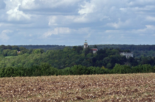
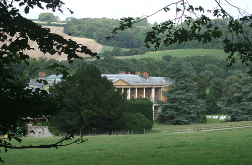
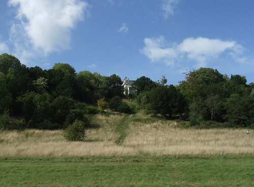
The byway curves up beside a wood, becomes a farm track past Harriotts End Farm, well sited on the corner of the ridge, and emerges on a quiet, tree-lined lane. I opt to follow this quiet lane northwards to its end. In the 18th century a number of parkland estates were developed round here and I could cut off to explore the remains of one of them, Ashlyns, where the Regency villa still stands, now used as offices, a residential care home and boarding school. Adjoining this was another villa in a park, Haresfoot, but only its pretty home farm remains, just off the lane to the right. But my eye is drawn on the map to a little pocket of wooded access land, presumably the remnants of a common, from where a long straight path runs mainly through open space straight towards the town centre.

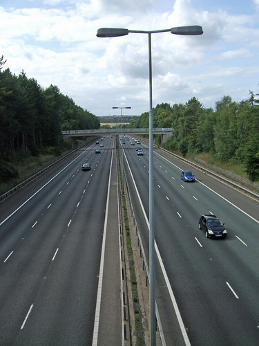
The natural course of the lane is blocked by the A41 dual carriageway, where it's been diverted to run down to a split level junction. The road is a landmark of our clockwise progress: it's the first of the major roads north from London we've encountered on our journey so far, linking London, Birmingham and Birkenhead. This section is, of course, a modern bypass: the historic route ran through Berkhamstead as its high street, making use of a length of Roman road, Akeman Street, originally a link between St Albans and Cirencester. In 1762 it became a key link in the developing modern road system as part of the Sparrows Hernel Turnpike between Bushey and Aylesbury, linking to the Edgware Road to London's West End in the south (itself largely a Roman road) and turnpikes to Birmingham in the north. The whole route became a trunk road in the last century, threading an alternative course from Oxford Street near Marble Arch via Baker Street and Swiss Cottage, still the main route north from the West End. With the opening of the M40 and M42, its importance has declined and some sections have been detrunked and even renumbered, but here, just south of Berkhamsted, it's still a very busy highway of near-motorway proportions, embedded, like the M40, in a ditch.

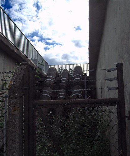
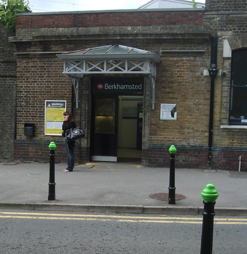
On the other side of the motorway bridge, a stile built onto the crash barrier takes me into the woods and along a path that's clearly not especially well used, but still possible to follow as it winds between trees and holly bushes. It emerges on a street, Kingshill Way, that bounds Berkhamsted's built-up area. A short way along to the left is the J Paul Getty Jr Conservation Centre, the headquarters of the British Film Institute National Archive, one of the biggest film archives in the world, endowed by the American-born philanthropist John Paul Getty Jr (1932-2003). The walk, however, continues straight ahead through playing fields belonging to Berkhamsted School. This minor public school dates back to 1541, when it was founded by John Incent (1480-1545), then Dean of St Paul's Cathedral in London, which we'll pass when London Underfoot reaches the Jubilee Walkway.

berkhamstedcollegiategrounds

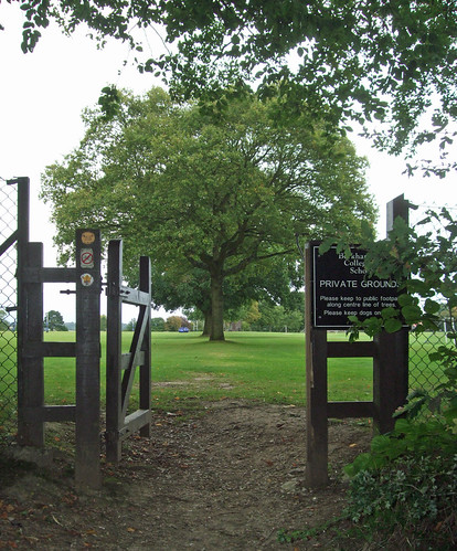
The long, straight line of the footpath, bisecting the playing fields along a row of mature trees, suggests this is an old route into the town that once passed through farmland or open land at this point -- thankfully it's not (so far) been fenced off or shut by a child protection panic. After the playing fields it becomes a surfaced, enclosed path, crosses residential streets and continues through a public open space, Butts Meadow. The name immediately signals a connection to archery, and indeed this was an archery practice ground from at least the time of Edward the "Black Prince" (1330-76), whom we've encountered before as he held the estate of Byfleet. The last record of active archers is in the 18th century, and now it's a relatively plain but pleasant open space, surrounded by rich hedgerows and popular with dog walkers, with a verdant slope that gives a good prospect of the town down in the Bulbourne valley.

There are three keystones to Berkhamsted's history: the highway, the castle and the market. Roman Akeman Street found a convenient route through the Chilterns here, along the valley of the river Bulbourne, a tributary of another Chiltern stream, the Gade, with its confluence at Hemel Hempstead, eventually draining into the Thames via the Colne. Even before the Romans, there is archaeological evidence of Neolithic, Bronze and Iron Age occupation in the vicinity. The site of Berkhamsted Castle, on the opposite side of the Bulbourne from my viewpoint, was originally fortified in Saxon times, and Grim's Ditch, a Saxon earthwork of uncertain purpose that we'll later encounter on the London Loop, crosses Berkhamsted Common. Little is known of the early days, then the town bursts spectacularly into the historical record in one of those years every British school child once had embedded in their memory -- 1066.

Berkhamsted was the point at which the Norman invasion of England became the Norman Conquest; Guillaume le Bâtard (1027-87), the Duke of Normandy, secured his claim to becoming William I of England; and the Celtic and Germanic cultures of the British Isles started their metamorphosis into the weird Anglo-French hybrid we know today. In early December 1066, with the Norman forces encircling London, Edgar Ætheling (1051-1126), uncrowned heir to the English throne and descendant of the house of Wessex, surrendered to the Conqueror here. Guillaume could have been crowned there and then, but clearly thought this Hertfordshire backwater an insufficiently glamourous and symbolic backdrop. Instead, he demanded the keys to London, where his coronation went ahead in Westminster Abbey (also on the Jubilee Walkway) on Christmas Day.

Following the Conquest, the castle was rebuilt in stone and became a favourite haunt of the Plantagenet royals. Doomed Archbishop of Canterbury Thomas Becket was once the constable -- his overspending on the castle is thought to be one of the things that enraged his patron Henry II, contributing indirectly to his assassination. An equally ill-fated historical figure connected with the town is Edward II: he gave the castle to his lover Piers Gaveston, who got married there. The Black Prince had a particular affection for the town, choosing it as his honeymoon location and giving it an historic connection to the Duchy of Cornwall. With its military function long since superceded, the castle was finally abandoned in 1495, in the early days of Tudor England.

Meanwhile, in 1217 Berkhamsted had become a market town, making it a thriving local centre as well as a stop on a major highway. The road was turnpiked in 1762, and in 1798 a new line of communication opened alongside it, when the Bulbourne was largely dug up to become part of the Grand Union Canal. 1838 saw the opening of the London and Birmingham Railway, a third trunk transport route squeezing along the valley. Berkhamsted Common, northwest of the town, was the site in 1866 of a celebrated campaign to save common land for the enjoyment of all against enclosure.

berkhamstedsign
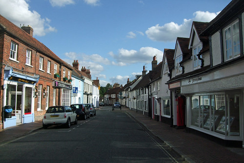
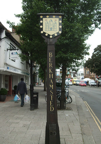
Our path, once the route linking the Butts to the Castle, emerges by a school and the obvious route ahead becomes Prince Edward Road, recalling the historic connection to the Black Prince. This emerges on the High Street right by the market. Old Akeman Street is now bypassed and traffic calmed, displaying a mix of building styles that still preserves some houses and pubs that would have been familiar to coach passengers passing on the turnpike. The historic market place has succumbed to car parks and shopping centres, but open air traders still set out their stalls on the High Street on this mild September Saturday. A town sign displays the arms, featuring a stylised castle with gold dots -- "besants" -- on a black border, the heraldic code for the Duchy of Cornwall.

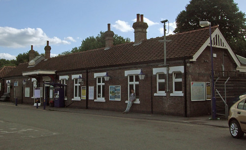
I keep as straight ahead as I can, across the High Street, through the car park which now occupies the market square site, and along Mill Lane, passing another campus of Berkhamsted School. A short stretch of residential street takes me past Canal Fields, a pleasant public space that received a Millennium makeover, with the twin ribbons of the canal and the railway ahead. A short stretch of recently reengineered footpath takes me up to a bridge and over the canal where the station is immediately visible on the left.

berkhamsteadstation

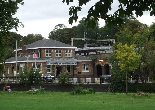
The 220km Grand Union Canal links London and Birmingham, from the river Thames at Brentford, with an arm to Paddington and on via the Regents Canal to the Thames at Limehouse, to Warwick Bar by the Banana Warehouse on the edge of Birmingham city centre. Stretches of the canal towpath further towards London form key sections of the London Loop, Capital Ring and Jubilee Greenway, so we'll say more about it when we walk these routes. The London and Birmingham railway, later part of the London and North Western and the London Midland and Scottish Railways, is our first encounter with a major intercity railway line north from the capital. It now forms part of Network Rail's West Coast Main Line, one of Britain's most important trunk routes, carrying Virgin Pendolino tilting trains from Euston not only to Birmingham, Britain's second biggest city, but on to Manchester, Liverpool and Glasgow, the country's ninth, fourth and third biggest cities respectively.

Don't jump on a train, however, without detouring under the railway and visiting the site of the Castle, just behind the station and also on the Berkhamsted Heritage Walk. Since its desertion at the end of the 15th century, much of its masonry has been cannibalised -- some is even incorporated into the viaduct and embankment of the railway -- but you can still climb the motte and survey the line of the moat, with just enough remnants of walls to pick up the floor plan.

berkhamstedcastle-view

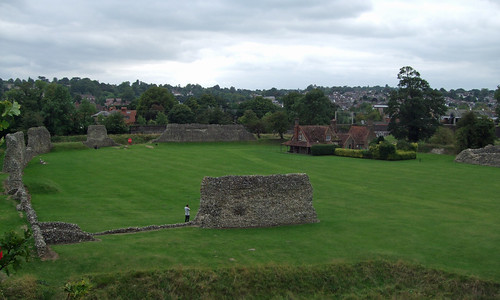
The site is now in the care of English Heritage, the government agency that presides over most of the "heritage" the National Trust hasn't snaffled up, and it's free to visit, with a good job made of interpretation boards. With all the grass it's a pleasant open space, though perhaps undervalued for a site that witnessed such a vital turning point in English history. Imagine the Black Prince and his retinue celebrating his wedding party if you can, or Edgar kowtowing to his new Norman masters (how did it feel as the agent of such a seismic shift in history?) or maybe the doomed Edward and Piers in a passionate embrace among the overgrowth sprouting from the decaying brickwork as the Pendolini whistle past nearby. On the way back, a cluster of curious bollards topped with luminous green will guide you to an alternative station entrance.

berkhamstedstation-greenposts

Download a route description PDF

View Google map
http://maps.google.com/maps/ms?ie=UTF8&hl=en&oe=UTF8&start=323&num=200&msa=0&msid=117966169375523396049.00046414d40d8252e7b70&ll=51.707134,-0.706859&spn=0.001599,0.00478&t=h&z=18

More information

London Countryway 7: West Wycombe - Great Missenden

redkite

On this section and the next, the London Countryway continues through the Chilterns in almost entirely rural and remarkably quiet surroundings. This is where the roller coaster really gets into its stride with ups and downs over minor chalk ridges, your leg musles testifying to the route's alignment against the geological grain as it wanders through a succession of field edges, beech woods and ridgetop hamlets. It's amazing that such a contrasting environment exists within such easy reach of the big city, and that fewer people don't explore it -- I passed a few dog walkers and occasional strollers, but hardly anyone clutching an OS map, certainly in comparison to the Downs or the Surrey Heaths.

I opt to catch the bus from High Wycombe to the start of the section rather than retrace my steps, finding some pleasant streets and the Eden Centre, built over the river Wye and partly hidden under the A40. It's a brand new shopping mall and leisure complex, partly outdoor, partly indoor, that shows how much the design of these places has progressed, built on a big scale but still navigable, the routes through it self explanatory. The bus drops near the Pedestal Roundabout, so named because a classical-style white pedestal stands at the junction, presumably another Dashwood folly.

pedestalfootpath

The path from the A4010 soon crosses under the railway through a well-weathered brick arch, then climbs slowly through fields, with fine views back towards Wycombe Hill. Eventually the church's distinctive palla d'oro disappears behind a ridge and the path approaches lonely wooden farm buildings grouped around a cinder courtyard. From here it picks up the drive to Cookshall Farm, but pretty soon the drive swerves left and the right of way leaves it to continue more-or-less ahead through trees. From the aerial photo it looks likely the straight alignment of the right of way is the original one, while the metalled farm track is a later diversion. The Countryway's creator and 1981-vintage guidebook writer Keith Chesterton suggests no-one will hassle you for using the farm track, and indeed a runner is using it as I approach, but the wood looks more inviting. At first the path is a broad green strip, with park-like woodland with silver birches and ferns on one side and a wilder beeches and oaks on the other, but it narrows to a woodland track before emerging into a field.

More woods ahead mark the first proper commons we've encountered since leaving Surrey, still part of the massive West Wycombe Estate but long managed as accessible public green space. There are in fact two adjacent commons, divided by a parish boundary. To the south is Downley Common, and the Countryway first reaches the northern extremity of this. The route then turns north through the short strip that links to Naphill Common, although the boundary is relatively recent, as Downley was once a "detached part" of Wycombe parish. Downley was once used for chalk and clay extraction, and during World War II was used as a testing ground for tanks made in High Wycombe. Naphill Common is bigger, the biggest in Buckinghamshire, but was once twice its present size, and less wooded, but the woodland flourished following the cessation of grazing after World War I and since 1951 it's been a Site of Special Scientific Interest precisely because of its longstanding lack of traditional grazing management.

naphillcommon

Both commons have active user groups -- the Downley Common Preservation Society and the Friends of Naphill Common. Both have been keen to facilitate walking on the commons -- Downley has a Millennium Trail, and the paths in both commons are very well waymarked, a blessing as it's easy to get lost given the dense woodland and the complex lattice of paths. The waymarking even includes the path numbers -- these are the numbers used on the "definitive map" of rights of way kept by the council, usually allocated on a parish-by-parish basis, and rarely appear on signs, but they're extremely useful here. For the most part our route is both a footpath, H12, and a bridleway, BW24, which through some quirk are recorded as separate rights of way although there's no obvious distinction on the ground.

waymarks-naphillcommon

The woodland spreads out westwards and I'm soon deep among the oak and beech. The fine old trees are often wreathed by holly, there's an occasional flourish of juniper, and big black beetles -- now known in educational parlance as "minibeasts" -- scurry through the twigs and mulch on the path surface.

blackbeetles

Eventually I arrive at the northwest corner of the common where a pleasing little collection of cottages looks out onto a green on the edge of the village of Naphill.

This is a sizeable village of the linear variety so common in these parts, strung out for some 1.5km along a road that is said to trace the boundary between the territories of two Celtic tribes. To the east were the Catuvellauni, who had their capital at St Albans, our destination in a few stages' time. To the west were the Atrebates, centred on Silchester -- both sites of course became important Roman settlements. The Atrebates' name could be cognate with Irish aitreibh, "building". The buildings here today are mainly of flint and brick -- the Black Lion pub, just set back from the main road, is a good example.

blacklionnaphill

The village owes much of its business, and its good bus connection, to the proximity of RAF High Wycombe just up the road at Walters Ash. This isn't an airfield but a command centre, the headquarters of Air Command, the pinnacle of the Air Force's command pyramid. Aerial photos reveal a rectangular structure with three circles in a field on the east of the complex -- this is the nuclear bunker where, during the Cold War, a team of bureaucrats sat ready to sound the four minute warning.

My mind turning to more cheerful matters, I head off northwest on a path well-used by locals that winds across meadows and fields towards a woodland, where I have my second wildlife moment of the day. I'm no birder, but even I notice the large birds dramatically swooping and calling with piping voices around the edge of the woods as I approach. These are red kites, and they represent one of the great conservation success stories of recent years. Once common birds of prey in Britain, they were added to the list of vermin in the 19th century and persecuted to near extinction, surviving only in small numbers in isolated Welsh valleys. From 1989 birds from Spain were reintroduced in the Chilterns, and they have flourished, with over 200 breeding pairs. They've since been reintroduced to several other sites in England and Scotland, sometimes using Chiltern-born chicks, including around Callander in Loch Lomond and the Trossachs National Park, another of my favourite places for walking. Yes, I'll stoop to a cliché -- 'magnificent birds'. They put a smile on my face, and I wonder if the birds I spot now have descendants north of the border. I certainly rather see red kites in the sky than Bomber Command.

uppernorthdean

The broad ridge that supports Naphill descends through North Dean Woods to the hamlet of Upper North Dean, where there are bus stops, but only for services that seem to run once on Tuesdays. This is one part of the country where the council have revived the use of traditional fingerpost road signs as more fitting to the local environment, as the result of a welcoming loosening of regulations at the Department for Transport.

northdeansign

The route then climbs again, up a hill and towards a wood, and along a surfaced track past the settlement known as Piggotts. This is the venue for the Music Camp founded by scientist Bernard Wheeler Robinson (1904-97) in 1927 near Hitchin, which moved here when it became Robinson's home in 1963. Twice a year, amateur musicians gather here for nine days of communal music making, including tackling ambitious works by the likes of Olivier Messiaen, as well popular composers like Sondheim. Piggots has even hosted its own Ring Cycle.

At the end of the track is Piggotts Hill House, set back at the end of a long drive, but I'm deterred from taking a photo by an angry dog that comes bounding down the drive towards me. There's no gate, and I'm dubious as to whether the invisible forcefield at the limits of its territory will hold the beast, so I hastily continue around the house wall and back into woods.

The path descends to another small hamlet, Bryants Bottom, and then steeply back onto a ridge surmounted by Denner Hill Farm, where some old barns have been converted into impressive homes. Then it's down again through a rough field with fantastic views to Hampden Road, which marks the district council boundary between Wycombe and Chiltern districts.

hampdenview

From here another path runs uphill through a field towards a wood, the delightfully named Nanfan Wood, then across to the equally oddly named Hangings Lane on the edge of the sizeable village of Prestwood. This, the sister village of Great Missenden, is an example of the more common fate of areas of common land following enclosure -- originally a common that formed part of the Mandeville estate, as in Stoke Mandeville, it was developed in Victorian times, taking advantage of its position on what was then a main road between London and Birmingham. In the local 1960s the former cherry orchards were developed as overspill housing in a government initiative.

Rather uncharacteristically, the Countryway does some suburban wiggling through the village's residential streets, mainly I think as Chesterton is anxious to show us the Glebe, a pretty row of whitewashed cottages just off Kiln Lane. The gravel path that runs under a wooden archway just by these looks like a garden path, but is actually a right of way that leads into a road on the other side -- the residents entertain walkers further by keeping pretty patches of garden across the path from their homes.

prestwoodglebe

From Prestwood Farm the route heads out across fields, downhill again and through Rignall Wood. Behind me I hear the thrum of a vehicle which turns out to be a golf buggy affair, moving at a walking pace -- and towing a horse! An example of the world turned upside down, or yet another example of the curious modern phobia of physical activity?

towingahorse

At Coney Cottage, just along from Rignall Farm, I spot a proud array of rosettes pineed on the wall of a stable. A sign warns the horses are microchipped -- presumably, like Spike in Buffy the Vampire Slayer, they can only act aggressively towards demons and vampires. I wish the same could be said of the local dogs.

rosettes

Beyond this the fields flatten towards the railway to Aylesbury. Just before the tunnel under the railway, it's joined from the left by the South Buckinghamshire Way, one of a number of routes in the county originally proposed by Ramblers members but adopted by the county council. Northwest, the South Bucks Way fairly soon meets the Ridgeway National Trail near Coombe Hill, and ambitious walkers can link from there via the Ridgeway to the North Bucks Way, the first in a chain of paths that together make up the Midshires Way through middle England to Stockport, Greater Manchester, where there's a connection to the Pennine Bridleway. You could follow signed paths from here through the Pennines to Byrness and on along the Pennine Way across the Scottish border to Kirk Yetholm.

southbuckswaymark

On the other side of the railway is Mobwell, where the path passes a dry hollow. During wet weather a spring bubbles up here to become the river Misbourne, the suffix "bourne" indicating a watercourse that only appears intermittently.

misbourne-source

In fact the upper part of the river has in recent times been more dry than wet, thanks partly to dry weather, partly to water abstraction, with its course sometimes becoming obstructed, causing flooding when it does flow. It was dry between 2003 and 2007, causing much local excitement when it reappeared, but then disappeared again until early this year. The Chiltern Society are now campaigning to address the problems and properly restore the river's course. Downstream of Chalfont St Giles it's more consistently wet, and flows to join the river Colne at Denham, which in turn joins the Thames at Staines, so the waters that emerge here eventually graze the western edge of Greater London through the Colne Valley Regional Park.

Opposite the source is a substantial pub, the Black Horse, and the trail runs through its car park and on along strips of meadow beside the dry trench of the infant river. The Thames, too, looks like this on its very upper reaches near Kemble in Gloucestershire. Then you're walking between two rows of trees, with the roar of a busy road on your immediate left. This is the A413, an important link route between Gerrards Cross, Aylesbury and Banbury, the modern incarnation of that very old road that once linked London and Birmingham, and the subject of a song by cult singer-songwriter John Otway.

This section of the Countryway ends at a stile that takes you out onto the road, leaving the South Bucks Way, the next section continuing through fields opposite. But for the short link to Great Missenden station I keep ahead for a short distance on the South Bucks Way before cutting off on a convenient footpath towards the village centre. For the first time in a while there's the option of a convenient link to London -- the South Bucks Way continues down the Misbourne Valley to meet the Grand Union Canal towpath at Denham Lock, from where you can closely parallel and then join the London Loop.

greatmissendenhighstreet

Great Missenden is a large village still very much linear in focus, once a coaching stop on the old road, though thankfully now bypassed. It's worth taking a wander down the High Street to look at the church and the former Missenden Abbey -- the street itself is lined with historic cottages. The Red Pump Garage caught my eye -- it's actually now an estate agent, but the old petrol pumps, the sort that required an attendant to operate, are still in place. A notice on the door says the garage has been out of fuel since eight gallons cost more than £1. That's about 3p a litre.

redpumpgarage

The village's biggest visitor attraction today is the Roald Dahl Museum and Story Centre, located here since author Dahl (1916-90) lived locally in later life, although he was born in Llandaff of Norwegian parents -- Plas Roald Dahl at Cardiff Bay commemorates his attendance at the Norwegian Church located there. He's internationally known for his dark children's morality tales, notably Charlie and the Chocolate Factory which has been filmed succesfully twice, but I'll forever associate him with the ITV anthology series Tales of the Unexpected. The early episodes of this were introduced by Dahl himself, his thin and gangling frame in classic storyteller pose in a leather armchair next to an open fire, sardonically name dropping titbits of his international jet set gambling lifestyle. Looking at this neat little Chiltern village high street in comparison to the New York literary salons and Monte Carlo casinos of these anecdotes, I'm even more convinced of their phoniness.

By the station, the route connects to the Chiltern Heritage Trail, further details of which have proved difficult to track down. It was a millennium project of Chiltern District Council consisting of a walker's route and three interlinked, mainly road-based, cycling routes. Guides to the cycling routes are downloadable online, but the walking route was promoted in a booklet with a cover price, stocks of which have now run out, even though the route is thoroughly signed. The council tell me they don't even have any reference copies left, and a promise to send me a photocopy of the route map was unfulfilled at the time of writing. Since the route was created they've abolished their tourism service and transferred the person responsbile to other duties. It's too frequently the case with walking projects that a certain capital sum is spent on putting something in place but without any provision for its sustainability, so something that should be delivering a legacy for decades is left to founder, in this case over only a handful of years.

As to the railway, it's what binds Great Missenden to Metroland, and its story is also part of the story of the modern transport network in London. The world's first "metro" or high density urban underground railway, the Metropolitan Railway, opened in 1863 as a cut-and-cover line along the northern edge of central London, from the Great Western main line terminus at Paddington to a station on the edge of the City at Farringdon, almost all of which is still used by London Underground's Metropolitan, Hammersmith & City and Circle lines. The Met developed into one of the most important transport undertakings in London, eventually linking with the Metropolitan and District Railway to create the Circle Line. In 1933 it became a key component of the new state-owned London Passenger Transport Board, the ancestor of today's Transport for London.

The Met long harboured ambitions beyond moving bodies between the main line termini, workplaces and leisure venues of the urban area. As mentioned in the last section, at the beginning of the 20th century it was working to create its own main line in partnership with the Great Central Railway, incorporating part of the Wycome Railway at High Wycombe. Already, from the 1870s it had been busy extending its own lines northwest from Baker Street towards Harrow and deeper into the Home Counties. Great Missenden was joined to Baker Street and Aldgate when the extension from Chalfont to Amersham and Aylesbury opened in 1892. From Aylesbury it took over an existing railway to Verney Junction, 80km from Baker Street, where there was an interchange with the London and North Western Railway's branch line from Bletchley to Oxford; for a while it also took over the Brill Tramway, originally a railway privately owned by the Duke of Buckingham, which connected Quainton Road on the Verney Junction line to Brill. But plans for further expansion foundered and Verney Junction and Brill remain historically the furthest outposts of the Metropolitan Railway and later the London Underground.

Brill's status as a London tube station was cut short when the line was closed in 1935; passenger services north of Aylesbury ceased two years later though were revived to Quainton Road for a few years in the 1940s and sections of the line continued to be used for freight. In 2008 a short length north of Aylesbury came back into use with the opening of Aylesbury Vale Parkway, but by this time the aberration of this long reach of the Underground had long since been addressed. In 1960, when the Metropolitan Line was fully electrified to Amersham, Underground services were cut back to there. British Rail took over the rest of the line to Aylesbury, its services leaving from Marylebone with limited stops to Amersham. This arrangement persists though private operator Chiltern Railways has since taken over from BR -- it's an odd joint service, involving the only stretch of line where National Rail trains run on London Underground metals.

In the early 20th century the Met came up with a novel business model for boosting traffic on its suburban lines: building its own suburbia. In 1903 it built a housing estate at Pinner and several others followed, some with stations opened specifically to serve developments. So a tentacle of classic suburbia began to fatten along the railway, promoted through posters and booklets under the name Metro-Land, most famously championed, and without the hyphen, some decades later by John Betjeman. The image was a bucolic one, of Englishmen's modest mock-Tudor castles set among greenery a convenient commute away from respectable City jobs. The message both drew upon and helped develop an ideology of Englishness as essentially rooted in an omnipresent rural past, at the very time the large-scale urbanisation and mechanisation were overturning the real life of the countryside. The truth of Metroland was dense new estates of near identical houses, imposed at a swoop on greenfield sites with little organic development around natural centres. It offered a regimented freedom that was neither rural nor urban. As Leslie Thomas puts it in one of the classic Metroland-set novels, Tropic of Ruislip, it was "in the country but not of it. The fields seemed touchable and yet remote".

The wisdom of allowing London to develop uncontrolled at the whim of private interests was always suspect and following World War II the government introduced planning controls and instituted the Green Belt, effectively putting a stop to the spread of Metroland. So it never did quite reach Great Missenden, and although there are patches of residential sprawl here and there on our journey, most date from 1960s overspill planning. Still, it's tempting to imagine this little station tucked away behind the village street, its platforms lined with London Transport roundels, in an English autumn dusk where bowler-hatted commuters from Aldgate and Moorgate turn homeward to evenings round open fires and the wireless, broadcasting John Betjeman, perhaps.

greatmissendenstation

Download a route description PDF


View Google map
http://maps.google.com/maps/ms?ie=UTF8&hl=en&oe=UTF8&start=323&num=200&msa=0&msid=117966169375523396049.00046414d40d8252e7b70&ll=51.707134,-0.706859&spn=0.001599,0.00478&t=h&z=18

More information


Wednesday 26 August 2009

London Countryway 6: Marlow - High Wycombe

wycombechurchview

Today the London Countryway launches into its second and final semi-circle and once again switches scenery as it enters the Chilterns, the last of its three Areas of Outstanding Natural Beauty. Like the previous AONBs, the Kent Downs and adjoining Surrey Hills, this one is centred on a chalk ridge, another ragged edge of the same chalk shelf, the debris of unimaginably old algae fossils, now emerging on the other side of the London basin.

Though there's a satisfying circularity to linking the two main chalk zones cradling the capital, the landscapes straddling the Countryway's course through them are markedly different. To the south we paralleled or walked astride the main chalk ridge itself for some time, enjoying wide views with their geology drawn in broad strokes, and the sense that we were tracing a wall. The Chilterns, by contrast, are more sprawling and less linear.

There is indeed a main ridge with a scarp slope and open downland looking over the Vale of Aylesbury, also traced by a National Trail, the Ridgeway, based on a prehistoric ridgetop trackway. One of Countryway inventor Keith Chesterton's first ideas was to link this with the North Downs Way along the southern ridge, but it runs further from London and he decided reaching it would take his route too far out. Instead, over the next four sections the Countryway traces a route some way southeast of the main ridge, cutting against the grain of several gentler and more rounded subsidiary ridges that run roughly perpendicular to the main one. So there's a series of ups and downs through a rolling agricultural landscape that's more intimate and enclosed than the drama of the North Downs, with more restricted views.

The AONB was designated in 1965 and covers 833 km2, running from the Goring Gap, where the Thames cuts through the chalk on the ancient boundary of Oxfordshire and Berkshire, in a 75km diagonal northeast to Hitchin, interrupted near the end by a gap to accommodate the urban area of Luton. Since 2005 it's been managed by a conservation board bringing all the councils together, but there's also a very active user group, the Chiltern Society, who help protect the AONB but also promote its enjoyment. They've been very active in maintaining the footpaths, producing maps and creating a number of longer walking routes, some of which we'll encounter. Buckinghamshire county council, in whose territory most of our route falls, also have a well-established network of routes, and between the council, the society and the AONB you won't be short of alternative suggestions for walks. There's even a cool interactive map of local routes on the AONB website.

Though the Chilterns claims to be the closest AONB to central London, rather than tracing the outer limits of the city, you now feel you're venturing far beyond it, with few obvious visual connections to the capital. I thought at first this might just be my lack of familiarity with the area -- though I already knew the North Downs relatively well, researching this walk is the first time I've explored the Chilterns. But outside the bigger towns on the main radial roads and railways, this really is very deep countryside.

Mostly it's attractive but unspectacular, low on major heritage sites, visitor attractions and features of interest, rich in wildlife. There are plenty of woods -- mainly beech and oak -- but they're patchy and dappled rather than the thick gnarled forests that cling to the scarp of the Downs. Elsewhere the land is arable farmed or used for horses, with the occasional common. Lots of footpaths start by climbing uphill through fields to woodlands at the top, emerging into one-street hamlets with cottages -- flint lined with brick, or sometimes whitewashed with red-tiled roofs -- strung along the roads that trace the ridgetops, before another footpath rollercoasters down and up to the next ridge. Good drainage through the chalk ensures the valleys are usually dry, so streams and rivers are few.

If you're after a classic country walk, these are excellent surroundings, mainly quiet and peaceful, with long stretches away from busy roads, the climbs exercising but not challengingly steep or long, the footpaths well-maintained and well-signed and surprisingly underused by visitors. But in some respects these are the least interesting sections of the Countryway so far, and certainly stretch the city walking remit of this blog.

The walk starts in surroundings that are urban enough, just outside the AONB boundary and just inside Buckinghamshire, in pretty Marlow by the Thames, the town where Mary Shelley wrote Frankenstein. The Countryway follows Pound Lane past Green Flag-accredited Higginson Park, an excellent and popular example of a traditional urban park created from an 18th century private garden in the 1920s, which sweeps down to the riverside.

You'll spot the sign that indicates one of the county council's circular walks passes this way. More sporadically signed is the Shakespeare's Way, which has joined us here from the Thames Path. Created by the people behind the Macmillan Way network of cross-country footpaths, this 235km path links William Shakespeare's birthplace at Stratford-upon-Avon with London and the Globe Theatre, a journey the writer himself must have undertaken on foot, although not necessarily on the same route. East of Marlow it follows pre-existing routes: the Thames Path to Cookham, then the Beeches Way (mentioned in the last section), the Grand Union Canal Walk and finally the Thames Path from Brentford to the Globe. This is just a brief encounter with Will's wandering ghost as we'll be seeing more of him in future walks.

malthouse

The Countryway soon leaves these routes just past a red brick maltings now converted into flats, heading up a good urban footpath to busy West Street with its pubs and restaurants. Continuing northwest up Oxford Road, though, you soon start to get the feel of a village street, leafy, quiet and lined with 18th century houses, though the United Reform Church looks more like an office building. Dodging down Queens Road we pick up a footpath beside the Duke of Cambridge pub that climbs uphill past allotments. Where the allotments end we're into the AONB and rising up above the Thames Valley with its wooded ridge beyond -- it's our last sight of the valley until near the end of the Countryway. Already there are chalk and flints underfoot, and a rich hedgerow to the side.

allotmentview-marlow

This fine path leads to a track just by the satellite hamlet of Bovingdon Green where for a short while we pick up the Chiltern Society's flagship walking route, the Chiltern Way. Originally created as the Society's millennium project, it's an expansive 200km circular walk exploring the length and breadth of the AONB, with two additional smaller loops linking to the Thames Path in the south and the Icknield Way in the north, another 94km in total.

chilternwaysign

Heading east from here will take you to Goring, cutting off a big southward meander of the Thames and linking to the Ridgeway, which you could if you wished follow southwest along the chalk towards Avebury and along the Wessex Ridgeway to Lyme Regis where fossil-rich cliffs mark the interface between chalk and sea. But our track runs east past a pretty farm and into our first Chiltern woodland, Blounts Wood, then the first hint of a rollercoaster down and up along field edges to End Farm.

tunnel-path

Here the Chiltern Way forks off, heading for Wendover and the northeast trajectory of the Ridgeway -- the National Trail ends at Ivinghoe where the trackway route continues via the Icknield Way and Pedders Way via Thetford to Hunstanton. Meanwhile the Countryway keeps roughly north on a bridleway uphill again and along the edge of another woodland, Highruse Wood. This picks up a lane to Copy Green, where an isolated flint cottage stands exposed by a small triangle of grass on a ridgetop plateau of farmland, possibly the loneliest place we've yet encountered on the Countryway. With old fashioned leaded windows, English roses growing by the window and cart tracks leading to the front door, it looks from the outside as if little has changed here for a century or so, except for the TV antennae on the chimney.

copygreen-cottages

More good bridleways now lead across fields west and then north alongside Shillingridge Wood, another rich beech woodland. The path emerges into a secluded valley, following a line a few metres up from the valley floor, and below us is the curiosity of Bluey's Farm. This is a neat and pretty group of buildings -- whitewashed and thatched cottages, a matching terrace of stables, and a wooden-framed brick house -- which back in the late 1970s intrigued Keith Chesterton with its "unreal and dreamlike" atmosphere.

blueysfarm

He discovered that all the buildings apart from the old brick house were built around 1960 as the private retreat of a Greek ship owner, a Mr Mavroleon, originally as a stud farm. I guess this was Basil Mavroleon, who married an Englishwoman and lived in Britain; or his son and heir Manuel Basil, who was nicknamed Bluey. The latter died in 2009, and the Daily Telegraph obituary recounts that "his son Carlos, a journalist working for CBS who had converted to Islam, died in mysterious circumstances in a hotel room in Peshawar, Pakistan, in 1998." The buildings have since been converted into a number of impressive private homes, the old half-doors of the stable stalls now replaced with picture windows, and it no longer seems such a lonely place as it must have done when Chesterton wrote about it, but there's still a trace of the "unreal and dreamlike".

The valley is still lovely, half coated with long stripes of trees -- a few leaves already turning bronze in late August -- and beyond the farm the path winds down to the bottom and enters another wood, Moor Wood, on a fine broad bridleway. The trees hear grow tall and straight, with little foliage on their lower branches -- the word 'cathedral' comes to mind.

cathedraltrees

The track eventually emerges on the Marlow Road, a well-used B-road, about a kilometre short of the village of Lane End. There's a short stretch along the road, with no footway but at least a little verge, and before the village the route heads off uphill across a field and towards a wood.

A search for peace and quiet round here is compromised by the constant buzz of light aircraft from Wycombe Air Park which is a short way to the east. Originally named Booker Airfield, it was built in 1939 as a civilian air training facility, but was not immediately used as such due to the outbreak of World War II. It finally began providing basic training to volunteer flyers and military glider pilots in 1941, still under civilian auspices. In the 1960s it became the base for the flying clubs of then national carriers BEA and BOAC, the ancestors of British Airways. The connection remains as the now-privatised BA operates it through a subsidiary as a base for training, gliders and light aircraft, so you might spot little Piper Dakotas with tails displaying BA's distinctive wavy red white and blue device, a livery more familiarly applied to Boeing 747s and Airbuses. The noise of aircraft is soon joined by the noise of shooting: adjacent to the air park is a shooting ground operated by EJ Churchill, the London-based gunmakers, claiming to be "the most prestigious shooting ground in the country".

Widdenton Park Wood is part of a former mediaeval estate and a Site of Special Scientific Interest (SSSI) thanks to its unusual combination of a typical Chilterns beech-oak woodland and wetter boggy areas fed by springs, with willow, birch and marshy grassland and a number of rare plants. On the top of the hill is an enclosed reservoir fed by springs, another dream-like place surrounded by neat green railings. The Countryway follows the fence and passes the main gate where no less than seven padlocks indicate the water company takes its security seriously.

sevenlocks

Our route out of the wood emerges on the drive to Churchill's shooting ground just short of a lane that crosses the M40 motorway. The motorway is the latest incarnation of the key highway link between London and Oxford, and continues beyond as a more pleasant and less congested alternative western route to the M1 and M6 between London and Birmingham. When it was completed in 1990 it was supposed to be the last major motorway scheme in the UK but successive governments have failed to withdraw successfully from their road building addiction and there have been several schemes since. It is, however, the newest of the major radial motorways encountered on this walk. For many years it was the only major motorway without any service areas, allegedly apart from some portaloos at Cherwell Valley in Oxfordshire, though this has now changed. This section, the High Wycombe bypass, was in fact the earliest to open, in 1967. Like much of the route through the Chilterns it's in a wooded cutting in an effort to minimise its impact on the environment, and is known as one of the more accident-prone stretches of the M40, as high speed commuter traffic shuffles with long distance goods vehicles.

m40

On the other side of the motorway a farm track runs parallel to it for a while, and what might have been a footbridge ahead turns out to be a service conduit carrying several serious looking pipes across the roaring traffic.

cablesoverM40

Then the track bends away past a farm and through another woodland and, earlier than expected, our destination is in sight -- the tower of St Lawrence's Church, West Wycombe, topped by a golden ball copied from the Palla d'Oro on the Punta della Dogana in Venice, rises from the trees over to the left. Soon we're descending on a lane alongside the wall that encloses the extensive parkland of the West Wycombe estate, into the valley of one of Britain's several rivers named Wye. This rises from the Chiltern chalk a little to the north, at Bradenham, and flows for 14km to the Thames at Bourne End between Cookham and Marlow: we passed close to this spot on the last walk. Wycombe is named for its once well-wooded valley -- Wye-Coombe -- and this geography will dominate our view for the rest of the walk. Near the valley's head, at this western end of the village, is the promontory of Wycombe Hill, with that distinctive church tower commanding the surroundings.

Along the valley floor between High Wycombe and West Wycombe runs the A40 road, which crosses the Wye nearby the point where our lane joins it at a T-junction. Although superceded by the M40, for centuries the road was one of London's vital radial routes, connecting the capital with the university city of Oxford. At the London end it forms one of the major east-west road alignments, from St Paul's via Holborn and Oxford Street. In parts, including at Wycombe, it follows much older routes that date back at least to Romano-British times. The dead straight alignment between West Wycombe and High Wycombe, however, isn't evidence of Roman engineering -- originally the road ran to the south of the river, until the current route was laid out as a grand avenue by local landowners the Dashwood family in the late 18th century using spoil excavated from the famous Hell-Fire Caves under Wycombe Hill.

viewfromwycombehill

The best known of the Dashwoods is the second baronet, Francis (1708-81), sometime MP, Postmaster General and Chancellor of the Exchequer, whose father, also Francis, had first bought the extensive estate -- some 20km2 -- in 1698. When mentioning Francis Dashwood it's customary to reach for the adjective 'notorious' for his association with the Hell-Fire Club, which met in the Caves and, allegedly, in the church's golden ball, as well as at Medmenham Abbey, not far away on the Thames. The built and landscaped heritage we see today is largely Francis' vision, inspired by a taste for Renaissance Italy then considered essential among English aristocrats raised on the Grand Tour, and indeed Francis' other social achievement was to found the Dilettanti Society, a dining club for those of his contemporaries who were equally admiring of Italian style.

westwycombehouse

There's a dramatic pedimented and double-collonaded mansion set within a Palladian park scattered with temples and follies; a preserved rustic village street; and over it all the hill, topped with its distinctive church and an octagonal mausoleum. There's an extravagance about it which belies English reserve, but tempered with good taste. In the 20th century the village and hill, and then the house through the donation of a particularly generous Dashwood, came into the hands of the National Trust. Family members still live in the house, however, and although it's partially open to the public as a stately home, it's also used as an events venue and for functions and corporate entertainment.

The Countryway doesn't run through the village itself but it's a very short and worthwhile diversion -- a collection of old inns, shops and cottages strung out along the A40, including a timbered-framed group at the east end that dates from the late 15th and early 16th centuries with delightfully sagging and overhanging upper stories. One of these is a traditional sweet shop and apparently none of them have foundations.

westwycombe

There's a kind of group harmony about the village that's difficult to convey in a single photo. The buildings set back from the road around the village hall also make an attractive little enclave.

wycombehill

The route sends me straight up the hillside towards the mausoleum, the last few metres a bit of a scramble up eroded chalk. Perhaps unfairly, the deliberate domineering use of scale, place, severe Portland stone and classical pastiche reminds me of some of the pretentious Nazi architecture I've recently seen at Luitpoldshain in Nürnberg. Among the urns is one containing Francis' ashes.

dashwoodmausoleum

The church, behind it, is a much more pleasing building. Both occupy the former site of an iron age hillfort that would have overlooked the ancient highway.

wycombechurch

I leave the hillside on a path that turns out to precede the one intended by Chesterton, and end up walking past the entrance to the Hell-Fire Caves, one of the supposed venues for Francis and friends' "notorious" behaviour, including alleged sacrifices and black masses. In fact there had been an earlier Hell-Fire club before the one Dashwood co-founded, and the name isn't of the members' choosing: they preferred to be known as the Knights of St Francis. Sex quite likely did play a role in some of club's activities; however its undocumented but enduring reputation for Satanism is most likely the result of a smear campaign conducted by the political enemies of Dashwood and his friends. Though a Tory, Francis was a reformer -- the caves were excavated partly to create work for unemployed labourers during a time of economic difficulty. His fellow members included the radical John Wilkes, satirical artist William Hogarth, and American Founding Father Benjamin Franklin.

hellfirecaves

I'm not sure quite how interested the current management are in setting the record straight on Dashwood. They run the Caves as a visitor attraction with much use of the word "notorious" in the publicity and flaming lighting effects playing in the lobby. Still, it looks like the outdoor café does a notoriously wicked cream tea.

The Countryway offers a choice at West Wycombe. This section officially ends a stretch of field path east of hill, which emerges by Flinthill Farm on the A4010 Bradenham Road, a little north of the Pedestal Roundabout that marks the eastern end of the village. The nearest major transport interchange is High Wycombe, 5km eastwards down the A40, rather too busy with traffic for most walkers. There's a decent bus service, so you could either finish your tour in the village or complete the whole section and catch the bus from the Pedestal Roundabout. The other walking option is along what Chesterton describes as "difficult paths on the left hand hill" -- that is, the north side of the Wye valley, on the left as you look east from Wycombe Hill. The difficulties, he explains, result from building work on a housing estate, with parks being blocked by rubble.

Keen to walk as much of the route as possible, I pick out the likely paths on the map and take a guess that in the near three decades since the guide was compiled, the difficulties have been resolved. I cut across a recreation ground, turn down a lane that takes me under the Chiltern Main Line railway (more of which later) and pick up the first of the paths, which starts out in a fashion that's fast becoming familiar -- up a hill towards a wood. The well used paths testify that we're getting close to a residential area, and I soon emerge on an open grassy slope where people are walking dogs and canoodling in the sunshine, with a good view over the valley below. Then we're out of the AONB and onto a residential street on the edge of Downley, once a separate village but now essentially a suburb of High Wycombe.

My guess turns out to be correct -- the path that now snake between fences through this massive area of what looks like 197os social housing development is clear and well-signed. It's clearly an old path, leafy and away from roads, now providing welcome permeability to some rather ordinary streets. One of the houses backing on to it has dispensed with its wooden back fence and replaced it with piles of old tyres.

tyrefence

Later, the path runs along the top of a remaining patch of open hillside that's now managed as a public park, Plomer Hill Open Space. The view here sweeps down to road and river, revealing the impressive size of the built-up area and the outlines of its geography.

plomerhill

The town has its own importance, independent of its role as a waypoint on the transport links between London and Oxford. Once a Roman settlement, it first appears on record under something like its current name in the 10th century, and was a market town from the 12th century. Industry has also played a major role, first mills, then furniture making. The latter is the traditional industry of the Cotswolds, where the artisans who turned the straight trunks and branches of the local beeches into chairs were known as "bodgers", a term that has taken on an unflattering meaning in everyday English, though there's nothing to suggest the original Chiltern variety were anything less than skilled and conscientious craftspeople. Today, the town has a population of just under 100,000, making it the biggest in the county, and an urban industrial character that's unexpected for a commuter town in the otherwise prosperous Home Counties, with some seriously deprived areas. Some local paper headlines -- such as the shooting of a woman at point blank range on a nightclub dancefloor -- could be straight out of Peckham or Haringey.

At the other end of the open space the route has been buried under housing. Cascading down the hill is a warren-like 1960s estate, crossed by a web of little paths that are intended more as short links between homes than sensible through routes, so I stick to the roads. I'm actually quite enjoying this walk as a contrast to the rural character of much of the route. It's fresh up here, with occasional glimpses down the hill -- the relief is steep enough to remain visible through the street pattern, demanding the little council houses respect its contours, and you can imagine what an airy ridge this must have been before the town claimed the hillside. Eventually I start to wind downhill, passing some flats in Garratts Way that for some reason resemble modern church buildings, and find an unmapped path that descends by the side of the railway line, emerging just shy of the town centre on Parker Knoll Way with its furniture-themed name, opposite a big Morrisons supermarket.

The route into town takes me under a magnificent viaduct carrying the Chiltern main line. Just on the other side of this, on the west side of Archway, is a skateboard park with a large piece of railway-themed grafitti art.

highwycombeskateboard

Unfortunately having admired this I'm forced to backtrack as the crossing arrangements at this busy road junction are frustratingly limited and the pedestrian routes not obvious. The crossings look relatively new but the area still needs a rethink from the point of view of the walker.

I suspect that once it was even worse, as in the 1960s High Wycombe's was one of those historic town centres comprehensively vandalised in the name of modernism and the motor car. The Wye was covered over, and swathes of 18th and 19th century buildings were bulldozed in favour of concrete shopping precincts and car parks knotted within impenetrable highways, on the model then being imposed on a larger scale in Birmingham. Recently there have been some efforts to put things right, under the banner of the "Eden Project" -- the deliberate namedropping of Tim Smits' eco theme park near St Austell is stretching things a bit. Sadly an early proposal to open up the river again was dropped, but the new shopping centre is fine as these places go and pedestrianisation and "public realm" improvements have made what remains of the mediaeval street pattern more walkable.

My approach to the centre is pleasant enough. Frogmoor extends out right to create a pleasant open space with a curious sculpture depicting a stylised family.

highwycombesculpture

Historically this was the location for landmark fountains -- the current incumbent is a "holes in the ground" job that barely functions, though there are plans to build a new one based on the Arch of Chairs that was created to welcome Queen Victoria in 1877. A fingerpost points to the twin town of Kelkheim, in the Taurus mountains near Frankfurt am Main.

My route bends down to the impressive All Saints Church, dating back to the late 12th century and rebuilt several times since, still with Roman stones in the masonry. From here you can catch sight of one of the most interesting historic buildings, the 18th century Market Hall, which owes its present colonnaded form to a rebuild by Robert Adam.

highwycombemarkethall

I follow Castle Street past a pleasant memorial gardens: just uphill from this is the Wycombe Museum, which predictably has a fine collection of furniture as well as social history and art exhibits. The street ends right opposite the station, by a pub called, for obvious reasons when you see it, the Flint House.

The railway takes us back to London both literally and metaphorically, as it played a role in the history of one of the organisations that most shaped the modern capital, the Metropolitan Railway, one of the most important direct commercial ancestors of today's Transport for London.

highwycombestation

The station was originally built by Isambard Kingdom Brunel in 1854 as the terminus of a branch of the Great Western Railway from Maidenhead -- the northern part of this was closed in 1970 while the southern section from Bourne End to Maidenhead, with its later spur to Marlow, remains as the "Marlow Donkey" line that we encountered on the last walk. In the 1870s the line was extended from High Wycombe to meet the Great Western's main line between Oxford and Didcot, with a branch from Princes Risborough to Aylesbury, though the northern section of this, too, was lost in the 1960s. At the turn of the last century, sections of the line featured in the Met's ambitions to reach beyond its urban origins and create a genuine main line. The Met paired up with the Midlands-based Great Central Railway, which had its own ambitions for a London extension. The GCR and GWR teamed up to create a line from the GCR near Bicester, joining the Wycombe line at Princes Risborough and then continuing direct to London via Denham and Ruislip, with the original intention of linking with the Met. But the GCR and the Met fell out, and the GCR built its own terminus at Marylebone in 1899, though substantial sections of the southern part of the GCR line ran on parallel tracks.

There will be more to discuss on the hinterland of the Met on later walks, but for the moment it's pleasing to note that the route, though still not one of the great radial main lines, is currently enjoying much more of a main line type service than it's had in years. Chiltern Railways, who currently hold the franchise on this group of National Rail lines, run services from Marylebone to Stratford-upon-Avon (Shakespeare again) and Birmingham, a much more pleasant way to reach the latter from London than Virgin's only slightly faster service from Euston, and since 2008 the trains of "open access" operator Wrexham & Shropshire have run through, though without stopping, on their way to and from North Wales.

As well as retaining the curious ceremony of annually weighing the Mayor to see if s/he has got fat at taxpayers' expense, Wycombe has numerous celebrity connections -- Benjamin Disraeli was a local MP; Dusty Springfield, Ian Dury and philosopher Karl Popper lived here; former Doctor Who star Colin Baker is a prominent local resident and a columnist on the local paper. But perhaps the most intriguing recent celebrity connection is that surrealist comedy team The Mighty Boosh first teamed up here when two of them were attending Bucks New University. Those council pebbledash units tumbling down the chalk hillsides towards the Wye might conceivably provide a backdrop to the antics of Bubblegum Charlie, or the Crack Fox.


Download a route description PDF

View a Google map http://maps.google.co.uk/maps/ms?ie=UTF8&hl=en&oe=UTF8&num=200&start=219&msa=0&msid=117966169375523396049.00046414d40d8252e7b70&ll=51.550605,-0.714111&spn=0.191284,0.441513&t=h&z=11

More information

Visit Buckinghamshire http://www.visitbuckinghamshire.org/


  • Walking in Buckinghamshire (Visit Buckinghamshire) http://www.visitbuckinghamshire.org/site/walking-in-buckinghamshire
  • Buckinghamshire Walks and Rides (Bucks CC) http://www.buckscc.gov.uk/bcc/row/getting_out_on_the_network.page?
  • Buckinghamshire Leisure & Culture (including parks) http://www.buckscc.gov.uk/bcc/leisure/Leisure__culture.page?
  • Wycombe District Council http://www.wycombe.gov.uk/
  • Wycombe Tourism http://www.wycombe.gov.uk/sitePages.asp?step=4&contentID=245&categoryID=1248
  • Wycombe Parks and Recreation http://www.wycombe.gov.uk/sitePages.asp?step=4&contentID=239&categoryID=1132
  • Marlow Town Council http://www.marlowtowncouncil.org.uk/
  • Marlow Branch Line (Wikipedia) http://en.wikipedia.org/wiki/Marlow_Branch_Line
  • Prince of Wales, Marlow http://www.the-prince-of-wales.co.uk/
  • All Saints Marlow http://www.allsaintsmarlow.org/
  • Higginson Park http://www.wycombe.gov.uk/sitePages.asp?step=4&contentID=220&categoryID=3617
  • River Thames (Environment Agency) http://www.environment-agency.gov.uk/homeandleisure/recreation/boating/31543.aspx
  • National Trails http://www.nationaltrail.co.uk/
  • Thames Path National Trail http://www.nationaltrail.co.uk/Thamespath/
  • River Thames (River Thames Alliance) http://www.visitthames.co.uk/
  • Salters Steamers http://www.salterssteamers.co.uk/
  • Shakespeare's Way http://www.shakespearesway.org/
  • Marlow Circular Walk http://www.buckscc.gov.uk/assets/content/bcc/docs/row/promoted_routes/marlow.pdf
  • Chilterns Area of Oustanding Natural Beauty http://www.chilternsaonb.org/
  • Chiltern Society http://www.chilternsociety.org.uk/
  • Chiltern Way http://www.chilternsociety.org.uk/content/about-ChltnWay.php
  • Great Marlow Parish Council http://www.bucksinfo.net/greatmarlow/
  • Lane End Parish Council http://www.laneendparishcouncil.org.uk/
  • Wycombe Air Park http://www.wycombeairpark.co.uk/
  • M40 Motorway (Wikipedia) http://en.wikipedia.org/wiki/M40_motorway
  • E J Churchill Shooting Ground http://www.ejchurchill.com/
  • West Wycombe Parish Council http://www.westwycombe.org.uk/
  • West Wycombe Estate http://www.west-wycombe-estate.co.uk/
  • West Wycombe Village and Hill (National Trust) http://www.nationaltrust.org.uk/main/w-westwycombevillageandhill
  • West Wycombe Park (National Trust) http://www.nationaltrust.org.uk/main/w-westwycombepark
  • River Wye (Wikipedia) http://en.wikipedia.org/wiki/River_Wye,_Buckinghamshire
  • A40 (Wikipedia) http://en.wikipedia.org/wiki/A40_road
  • West Wycombe & Bradenham Walks http://www.chilternsaonb.org/site_details.asp?siteID=391
  • St Lawrence Church Trust http://www.stlawrence-westwycombe.co.uk/
  • Hell-Fire Caves http://www.hellfirecaves.co.uk/
  • Chiltern Main Line (Wikipedia) http://en.wikipedia.org/wiki/Chiltern_Main_Line
  • Downley Parish Council http://www.downleypc.org/
  • Wycombe Museum http://www.wycombe.gov.uk/museum/
  • All Saints High Wycombe http://www.allsaintshighwycombe.org/
  • Eden Shopping Centre http://www.edenshopping.co.uk/

    •